Current Investigations

Active Research Projects

Systematic, interdisciplinary investigations combining remote sensing, predictive modeling, and field verification.

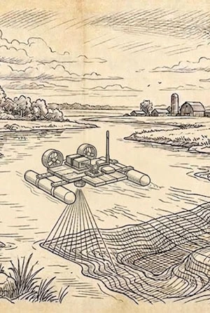
Vintage illustration of a blackwater river bordered by cypress trees and wetland vegetation.
Conceptual reconstruction of a blackwater river environment. Not a documented site.

Florida & Great Lakes Region

Micro Bathymetry

Active prototype testing

Designing portable sonar systems to map small, hazardous, remote, or blackwater bodies of water that are missing from existing bathymetric datasets.

Many submerged terrains may preserve evidence of past human activity, geological processes, and fossil deposits that remain invisible to conventional surface surveys.

Focus Areas

  • Unmapped rivers, ponds, reservoirs, and flooded mine features
  • Blackwater and low-visibility survey environments
  • Submerged terrain anomalies with research potential

Field Sites

  • Wacissa River
  • Aucilla River
  • St. Marks River
  • Pere Marquette River

What We're Looking For

  • Submerged sinkholes and karst features
  • Paleochannels and buried drainage patterns
  • Ledges, scour holes, and erosional exposures
  • Spring vents, basin edges, and abrupt depth changes
  • Anomalies that may warrant archaeological or paleontological follow-up

Technical Approach

  • Custom DIY sonar platforms
  • Side-scan and downscan imagery
  • GPS-linked depth logging
  • Trackline-based bathymetric modeling
  • GIS review of terrain and acoustic anomalies
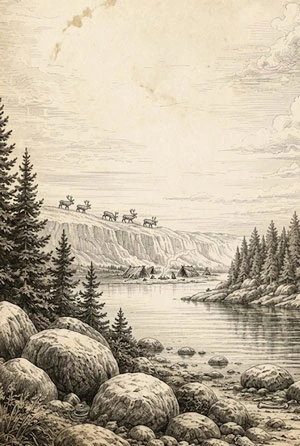
Vintage illustration of a glacial lake and upland environment with rocky shores and boreal forest.
Conceptual reconstruction of a glacial lake and upland environment. Not a documented site.

Central Upper Peninsula

Paleo Habitation in Michigan's Upper Peninsula

Predictive landscape modeling phase

Investigating early human occupation in Michigan's Upper Peninsula by combining published Paleoindian site evidence, local artifact histories, photogrammetric documentation, geology, LiDAR, and predictive landscape modeling.

A small number of formally documented sites contrasts with the volume of local reports, private collections, and long-standing accounts of early-style lithic finds across the region.

Focus Areas

  • Published Paleoindian evidence and under-documented local finds
  • Personal collections with known or approximate find locations
  • Ancient shorelines, travel corridors, lithic sources, and resource zones

Field Sites

  • Marquette County
  • Ishpeming area
  • Negaunee area
  • Central Upper Peninsula uplands

What We're Looking For

  • Fluted, lanceolate, and other early-style projectile points
  • Private collections with known or approximate find locations
  • Diagnostic lithic material, tool forms, flaking patterns, and raw material types
  • Local stories of repeated finds, camps, trails, quarries, or unusual stone concentrations
  • Landforms associated with ancient shorelines, terraces, overlooks, wetlands, and travel corridors

Technical Approach

  • Artifact photography, cataloging, and photogrammetry
  • Remote assessment of point style, material type, flaking, wear, and manufacturing traits
  • Local oral-history and find-report documentation
  • LiDAR review of terraces, ridges, paleoshorelines, and glacial landforms
  • Surficial geology, hydrology, and glacial history analysis
  • Predictive modeling of high-probability survey areas
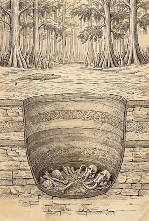
Vintage illustration of a Florida wetland landscape with cypress trees and limestone features.
Conceptual reconstruction of a Florida wetland landscape. Not a documented site.

North Florida Karst Region

Preservational Sinkholes in the Woodville Karst Plain

Remote sensing & field validation phase

Using machine learning, remote sensing, local knowledge, and field investigation to identify sinkhole features that may preserve archaeological or paleontological evidence in the Woodville Karst Plain.

Known sites such as Page-Ladson demonstrate that sinkholes and related karst features can preserve traces of ancient environments, extinct fauna, and possibly very early human activity.

Focus Areas

  • Dry and submerged sinkholes with preservational potential
  • Karst features near the Aucilla and Wacissa river systems
  • Candidate landscapes associated with early human and faunal deposition

Field Sites

  • Aucilla River basin
  • Wacissa River basin
  • Woodville Karst Plain
  • Adjacent karst uplands and submerged features

What We're Looking For

  • Dry sinkholes with sediment-trapping and preservational potential
  • Submerged sinkholes, vents, and karst depressions
  • Features associated with ancient depositional basins or organic preservation
  • Landscapes comparable to known sinkhole preservation contexts such as Page-Ladson
  • Areas where local knowledge, karst mapping, and terrain analysis converge

Technical Approach

  • Machine learning detection of candidate sinkhole features
  • LiDAR and terrain-based karst analysis
  • Historical map and hydrogeologic review
  • Integration of local knowledge and cave-system mapping
  • Field validation and prioritization of dry and submerged targets
Vintage illustration of a post-glacial river corridor with wetlands and upland terraces.
Conceptual reconstruction of a glacial lake and upland environment. Not a documented site.

Lower Michigan River Corridors

Paleo Habitation in Western Michigan

Local collections & field testing phase

Investigating likely locations of early human occupation in western Michigan by modeling post-glacial landscapes, river corridors, resource zones, and find patterns from nearby early Paleoindian and near-Clovis-period discoveries.

As the Laurentide Ice Sheet retreated, newly exposed landscapes in western Michigan would have opened rapidly to plants, animals, and eventually people. Recent discoveries in Lower Michigan and the broader Great Lakes region suggest the earliest chapters of human occupation remain incompletely documented.

Focus Areas

  • Earliest post-glacial occupation zones
  • Ancient river corridors, wetlands, and lake-margin landscapes
  • Candidate sites along the lower and middle Pere Marquette River basin

Field Sites

  • Pere Marquette River basin
  • Mason County
  • Lake Michigan coastal plain
  • Western Michigan uplands and terraces

What We're Looking For

  • Early-style lithic points, tools, flakes, and raw material concentrations
  • Ancient terraces, overlooks, crossings, and travel corridors
  • Former wetlands, springs, oxbows, and resource-rich ecotones
  • Gravel bars, erosional exposures, and disturbed contexts where older material may surface
  • Landforms associated with post-glacial animal movement and early human activity

Technical Approach

  • Post-glacial landscape reconstruction
  • LiDAR analysis of terraces, ridges, relict channels, and subtle landforms
  • Surficial geology, soils, hydrology, and glacial history review
  • Local artifact-history and oral-report cataloging
  • Predictive modeling of high-probability survey areas
  • Field verification with landowner permission

Contribute to Research

Landowner reports and local knowledge are essential to our discoveries.

Report a Find